|
|
GENERAL EQUIPMENT INC.
8724 Sunset Drive #191● Miami FL 33173 · USA
|
|
|
GENERAL EQUIPMENT INC.
8724 Sunset Drive #191● Miami FL 33173 · USA
|
F406
|
TYPE: |
Aircraft |
|
DESCRIPTION: |
F406 Twin Turbo Prop Multi Missions |
|
PRICE: |
Upon Request |
|
PACKING: |
Ex-Works |
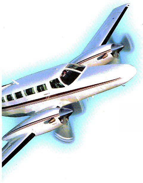
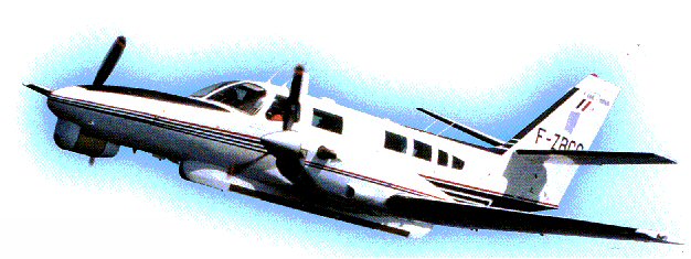
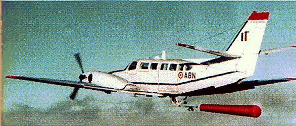
F406 TWIN TURBO PROP MULTI MISSIONS
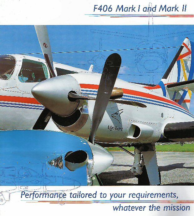
More Flexibility for more versatility
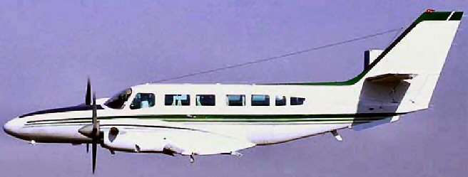

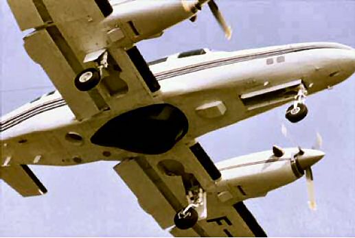
Based on the Cessna 400 series, the twin turbo-prop F406 Mark I and Mark II are entirely manufactured and assembled in France
The F406 is quickly operational, powerful, flexible and at ease in all situations
It excels under the most difficult operating conditions, is able to land in complete safety on temporary hard or semi-prepared runways and requires very short distances for take-off
Its level of technical and economic preformance combined with an adaptability tailored to each customer's exact requirements, makes the F406 a totally versatile plane with the lowest operating cost in its category
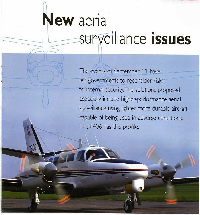
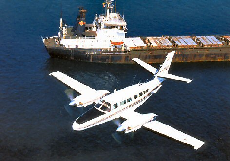
The F406 is widely used throughout the world by Governments, the Military and aerial survey companies. It is the logical choice for those companies that require a modern PT6A powered turbine twin with rugged reliability and low operating and low maintenance costs.
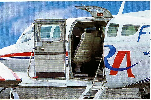
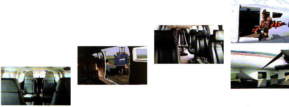
The large 69 x 54cm camera hatch with electric doors is located opposite the double cargo doors permitting safe direct loading and unloading of expensive equipment.
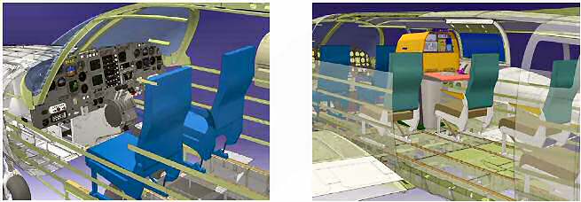
The wide cabin can accommodate a number of consoles or additional seats.
 |
 |
 |
 |
 |
 |
F406 aircraft ARE used for Survey with Leica LiDAR, Fisheries Patrol with 360° radar, Border Patrol with 20” FLIR and one used for commuter.
We can now offer early delivery of new aircraft equipped with a choice of Honeywell, Garmin, Collins and Universal avionics with or without EFIS.
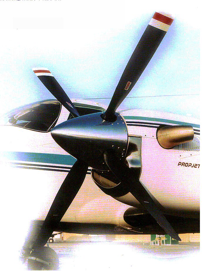
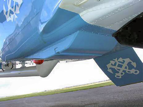
Each aircraft has the extra heavy duty corrosion protection that is unique to our aircraft and essential for overwater operations.
 |
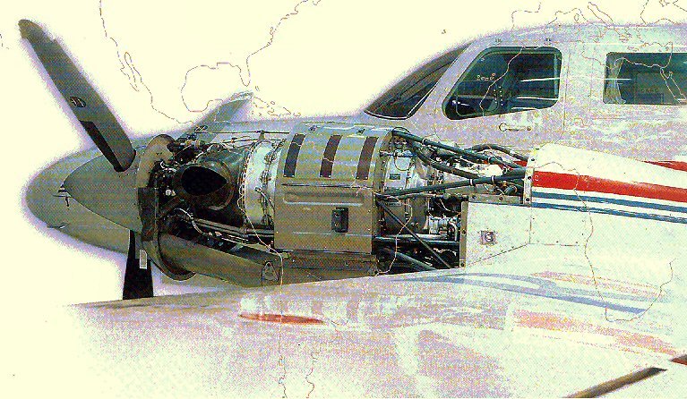
Built on a modular platform with proven robustness, the F406 Mark I and Mark II share the following technical characteristics:
For passenger and operator comfort, as well as to provide easy maintenance and servicing; the cabin is lined with east-to-dismantle composite panels which can be covered, on customer's demand with alcantara or ultra leather finishing. High capacity air conditioning ensures a pleasant flight even under the hottest conditions. |
 |
The resolutely modern avionics systems include three main features
All of which is completes with a three-axis auto-pilot and a weather radar |
 |
Many options are available for special missions or public passenger transport. A sophisticated full de-icing system enables the aircraft to fly safely under known icing conditions.
The F406 Mark I and Mark II differ in terms of their power unit and the maximum take-off weight: F406 Mark I
F406 Mark II
In its new Mark II version, the F406 offers even more scope in terms of power, range, autonomy, take-off weight and climb performance in hot weather. |
 |
Because each mission is unique
The F406 Mark I and Mark II are perfectly suited for two types of missions:
Based on a common platform, the F406 Mark I and Mark II configuration flexibility enables extreme customization, making the aircraft available for all "turnkey" missions.
Transport missions Its
performance level and reliability, low fuel consumption and
a simplified maintenance mode make the F406 and ideal
aircraft to achieve low operating cost and rapid return on
investment. |
Commuter
For the transport of 9 to 12 passengers under optimum conditions of comfort and safety
Executive
For the transport of 6 to 8 passengers in a VIP environment
Cargo and Combi
For the transport of freight or mixed freight/passenger transportation
Medevac
For sanitary and medical missions, stretcher and life support modules
Parachuting
For free fall or static line dropping of parachutists in either automatic or controlled mode
Training
For pilot and systems operator training
 |
Special Operations Speed, range, power and safety, the performance levels of the F406 Mark I and Mark II are perfectly suited to surveillance missions. The standard features of the F406 for special missions include:
Through long experience as system integrator, we offer every customer a solution tailored to each operator's specific requirements. |
 |
 |
 |
Different versions have already been developed:
|
 |
 |
MORE AVAILABILITY THROUGHOUT THE WORLD
From training to fleet management, we cover all F406 users' operational requirements via a complete service to flawless "turnkey" missions
TRAINING ..... TRTO
Pilots, mechanics and operators are trained in a TRTO approved department by highly qualified instructors, taking into account the trainees initial level of expertise and the specific features of each mission
MAINTENANCE .... PART 145, FAA
We guarantee maximum availability 24 hours a day, 7 days a week, for all F406's in service, throughout the world via:
A world wide network of approved service points,
Pratt & Whitney service centers
Teams on call for all five continents, to provide on-site technical assistance
REMOTE TECHNICAL SUPPORT
Via a direct contact point with the engineering office, production and certificate authorities, the customer support service is capable of responding in very short terms to all F406 operators queries
SPARE PARTS
All spare parts for the F406, whether for the aircraft structure, the equipment or the avionics, are available directly
WARRANTY
The F406 Mark I and Mark II are covered by international warranties:
Airframe: 1 year
Engines: 1000 hours
Propellers: 3 years
Avionics: 2 years

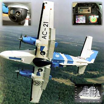
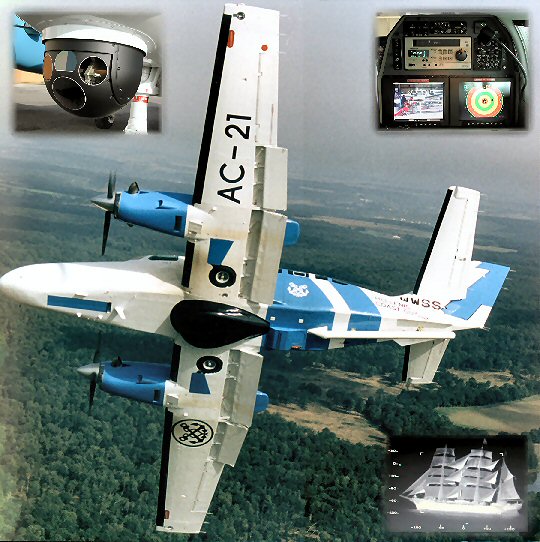
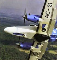
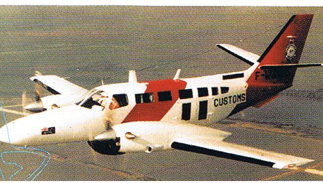
F 406 POLMAR VERSION
|
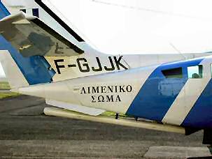
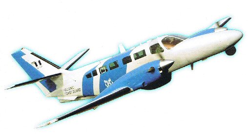
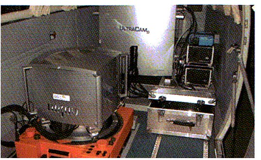
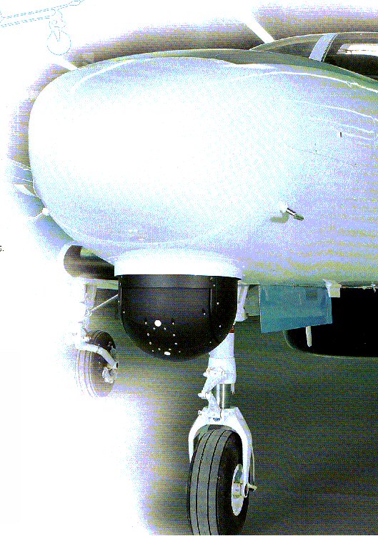
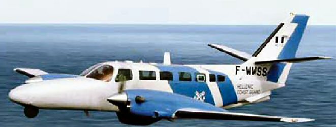
A typical aircraft with nose mounted FLIR and SLAR mounted under aft fuselage. This photo shows one of the three aircraft delivered to the Hellenic Coast Guard which has the belly mounted 360° Telephonics RDR1500B radar. A nose mounted RDR 1400C with 120°sector scan is also available. EQUIPMENT installed Oxygen system 114 cu ft Oxygen, light and air outlets in accordance with seating plan. De-icing Equipment: Certified for flight in Known Icing conditions. Complete with de-ice boots for the wings, horizontal and vertical stabiliser (As shown above), heated pilot’s window (LH). Propeller de-ice. Air conditioning 20,000 BTU, optimized for operator comfort. Heavy duty corrosion proofing. S-TEC Magic Engine Instrument Display System, including engine Parameter recorder Two pilot’s seats and three operator seats in the cabin ELT Artex C406-1 Emergency Locator Transmitter. RH flight instrument panel and full dual controls for co-pilot. NOTE: Our use of Catia version V5 enables us to design and construct the aircraft to the exact requirements of each client. |
|
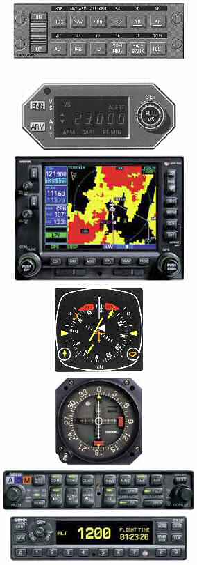
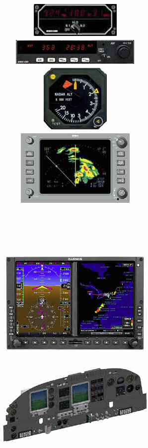
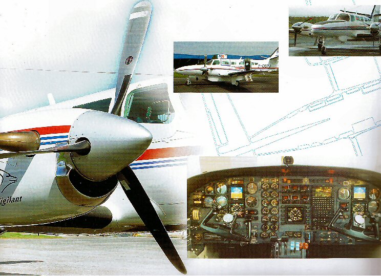
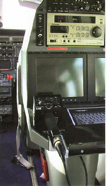
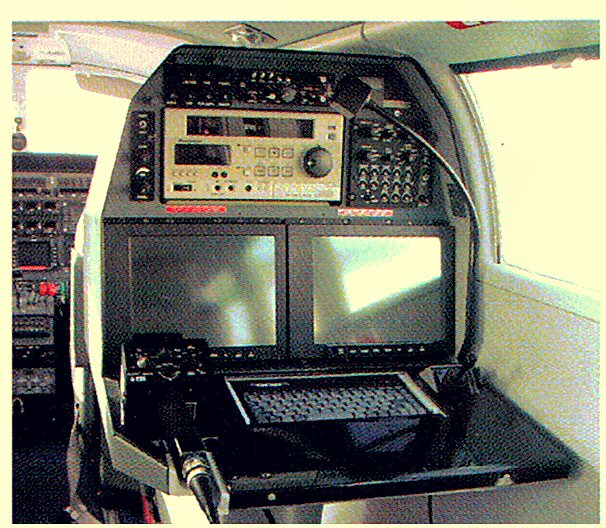
AVIONICS INSTALLED Honeywell / Garmin
package including: This is a 3 axis well proven system with soft ride, half bank and Yaw damper. Couplers for heading, NAV. GPS. ILS. VOR. KI 256 Attitude Indicator KI 525A HSI Navigation Indicator No 1 (shown below). KAS 297C Altitude Pre-select and alert. (shown right). KEA 346 Encoding Altimeter Two Garmin GNS 530W NAV/COMS with VOR/LOC/ILS and GPS GNS 530W is an all-in-one GPS/ Nav/Com. It features a WAAS-certified GPS, 2280-channel capacity COM and 200-channel NAV ILS/VOR with localizer and glideslope. Traditionally it would take a host of components to provide the capabilities of this one smart box N°1 NAV indicator is coupled to the autopilot and is displayed on the Honeywell King Silver Crown Plus KI 525i Horizontal Situation Indicator KCS 55A Remote compass system (An optional repeater indicator can be provided for the co-pilot) N°2 displayed on GI 106A Indicator Audio Garmin GMA 340 with 4 place intercom XPDR Garmin GTX 330 Digital Transponder Mode S |
|
|
DME KN63 DME with Indicator
ADF KR87 Digital ADF with KI227 Indicator
KRA405B Radar Altimeter
RDR 2000 Weather
Radar shown with KMD 850 Multi function Display (Upgrade at
extra cost with Terrain Awareness TAWS and Traffic Alert
Systems). In preparing this presentation we do not know of the area of operation or the aviation service capability available locally, therefore we have shown the standard aircraft with Electro mechanical instruments and No EFIS. We have supplied similar aircraft with 5 tube EFIS.
GARMIN 600 EFIS can now be offered; this would replace the LH and RH Flight Instrument panels but feature the avionics package shown above.
Universal EFIS is also available as an option. This shows the new S-TEC engine gauges, Gold Crown avionics with Universal UNS 1L Flight Management System.
|
|
|
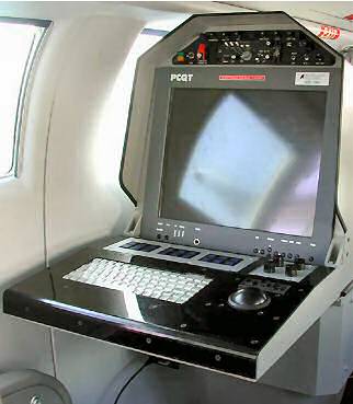
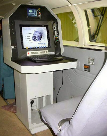
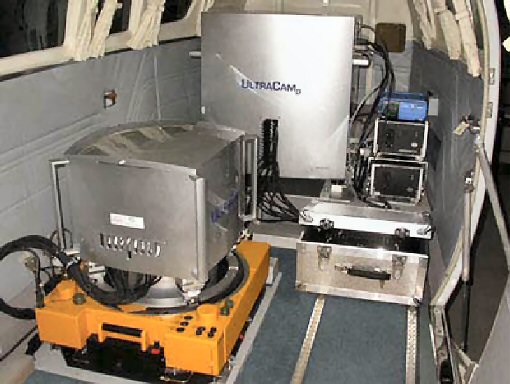
The Pollution Surveillance detection and recording system. The core of the system is a mission management system that links all available information together and presents a situation overview to the operator for interpretation and further action. The MMS is based on GIS (Geographical Information System) technology, and the available information is presented against a backdrop of a digital nautical or terrestrial chart. The information from on board sensors and external inputs is presented live to the operator and also recorded digitally for later analysis or sent by SATCOM TT-3068A Data Unit data link for immediate analysis. A post-processing station, located at the mission control centre and/or at the aircraft home base will allow replay of the mission data for continued analysis and processing.
|
|
|
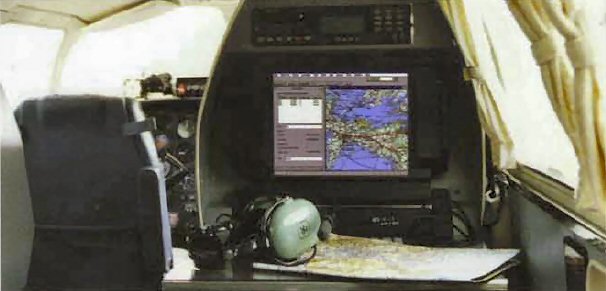
On Board Data Processing and analysis Sensor and data from all sources is processed and analysed on board and presented to the operator and digitally recorded either for real time transmission by SATCOM or for post flight and indepth analysis. Complex information is presented graphically for overview and to facilitate instant decision-making. We can also provide a pilot’s display in cockpit (with a simplified set of controls)
|
|
|
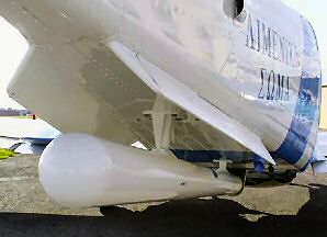
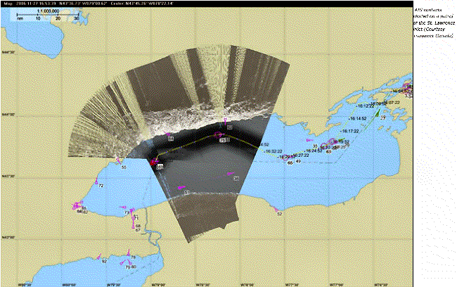
The main sensor of the Mission System is the Side-Looking Airborne Radar (SLAR): this is a mapping radar for surveillance of large sea surfaces. The figure to the right shows an Ericsson SLAR antenna mounted on the aircraft fuselage. The forward motion of the aircraft is utilized by the radar to scan the sea surface perpendicular to the flight track. Whereas traditional radars typically achieve less than twenty echoes per radar scan from each target, the SLAR obtains up to a thousand. This gives a very high capacity for detecting small targets as well as for showing sea surface properties. Oil floating on the sea surface has a dampening effect on the sea clutter (capillary waves) resulting in less radar return to the aircraft from an oil slick than from the surrounding, undisturbed water surface, and this contrast is clearly visible in the SLAR image The SLAR will typically cover: • 18,000 km² per hour for oil spill and small objects on the water surface• 48,000 km² per hour for large vessels
|
|
|
SLAR Objects with higher reflectivity to radar pulses than the sea surface will instead give a more intense radar return, and the resulting image will therefore show not only oil spills but also ships, boats and other small objects against a background picture of the sea surface. Thus the SLAR is the ideal sensor for large area surveillance for both oils pollution and very small vessels, target types that are difficult at best, and often impossible, to detect with traditional radar technology. The SLAR is a day and night sensor. It can be operated under all weather conditions and for GPS accuracy in positioning the SLAR image and will present the image either superimposed on a backdrop digital chart or display it as a traditional “scrolling waterfall”. The SLAR is designed for the maritime surveillance role and successfully strikes a balance between oil detection, small target detection, and ease of operation. IR/UV The Infrared/Ultraviolet (IR/UV) Line Scanner is used to obtain high resolution imagery of accident sites etc. It is capable of observing minute temperature differences on the water surface and is ideal for mapping oil spills and other types of pollution, as well as other types of hydrological phenomena such as upwelling warmer/colder water. The IR/UV scanner, operating in the 8.5-12.5μm region (IR) and in the 0.32-0.38 μm region (UV), provides high resolution imagery of oil spills and other features on the surface. IR data can be obtained both day and night providing information on the spreading of oil and also indicating the relative oil thickness within the oil slick. Usually 80% of the oil is concentrated within less than 20% of the visual oil slick. By using the IR information, the efficiency of clean-up operations can be greatly improved. UV data is obtained during daylight conditions, and is primarily used to map the entire extent of an oil slick, irrespective of thickness. The UV data adds confidence to the IR registration by distinguishing between natural thermal phenomena, such as cold upwelling water, from suspected oil pollution. It also assists an onscene commander in determining the location of the thicker parts an oil spill, thus adding to the efficiency of the clean-up operation. A high level GPS accuracy with the capability to either superimpose the IR and UV images on a backdrop digital chart or to display the images as a traditional “scrolling waterfall”. The information from the aircraft can be used as input to oil drift modeling, thus further enhancing the aircraft as an asset in oil spill contingency planning. |
 |
 |
|
The two cameras, (a still and video) are fitted provide digital imagery and video documentation. Each frame is annotated with relevant mission information for future, tamper-free reference. The built-in DGPS system provides accurate and consistent annotation of all observations by logging the time and position of each exposure and displaying this information in a selectable digital map overlay. This Imagery and other information are linked to the geographical position and to the operator's comment, thus creating a comprehensive folder of legally evidential data AIS- AUTOMATIC IDENTIFICATION SYSTEM A (normally silent) airborne AIS transponder is integrated within the system. The AIS receives identity information from all transponder equipped ships with VHF distance in the patrol area. Live AIS information is displayed on the map display and logged in the built-in target database. The possibility for the operator to immediately compare AIS information with target information acquired from other sensors will greatly facilitate the control of all sea surface activities within the patrol area. |
|
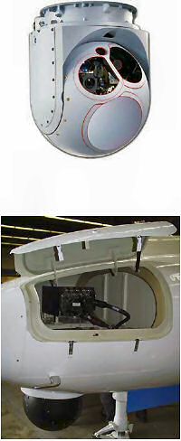
FLIR - FORWARD LOOKING INFRARED A FLIR is an indispensable supplementary sensor for most mission profiles. It will add day and night identification and documentation capability to complement the information gathered from other onboard or external sources. The FLIR is integrated into the surveillance system. Imagery from the FLIR is annotated and stored together with the all other mission data. The FLIR can also be slaved to any target position or geographical reference in the database as selected by the operator, thus facilitating the sorting and identification of targets detected by other means.
The FLIR is mounted in the nose with the processor mounted in the forward avionics bay for easy access. This unit has proven to be the most popular and most reliable one available.
|
|
|
Optional Equipment Search Radar A 360° or forward looking or search /tracking/ weather radar can be added to the system for general surveillance. The integrated system is designed to interface with a search radar for importing target tracks into the tactical map database. Track While Scan capability can be added. Whilst the SLAR unit has very high resolution it does not ’search ahead’ for vessels.
|
|
|
SATCOM For real-time in-flight data communication a SATCOM system is integrated with the system. With a highspeed SATCOM link the mission report with images and tactical map snapshots captured during the mission can be delivered while in the air or by e-mail or mobile phone after landing. With a low-speed SATCOM link only short messages with information of position and properties of observed activities on the sea surface will be delivered while in the air and mission report and pictures will follow by e-mail or mobile phone data transferred after landing. The recorded mission can also be replayed after landing in the aircraft or on a ground station. AVAILABILITY: TCAS 1 Traffic Collision Avoidance System EGPWS Ground Proximity Warning System RADAR 120° RDR 1400C in exchange for RDR 2000 Nose mounted |
Specification and photos are not contractual and are subject to verification upon inspection
TAKE NOTICE!
PLEASE BE ADVISED THAT INFORMATION INCLUDED IS CONFIDENTIAL IN NATURE AND IS BASED ON PRE-EXISTING BUSINESS RELATIONSHIP WITH THE LEGAL OWNER OF PROPERTY DESCRIBED HEREIN (IF APPLICABLE). AS SUCH, UPON RECEIPT OF SAID INFORMATION THE RECEIVER ACKNOWLEDGES THAT ANY UNAUTHORIZED CONTACT WITH SAID LEGAL SELLER WILL BE CHARACTERIZED AS A BREACH OF CONFIDENTIALITY AND SAID AGREEMENT MAY BE ENFORCED UNDER EXISTING LAW OR IN EQUITY.
This paper was prepared by
General Equipment Corp.
The paper represents an offer of a partner of General Equipment Corp.
All rights are reserved by and for General Equipment Corp..
All
content and ideas of this paper are the property of General Equipment Corp.
Defense items are subject to final destination approval and granting of an
export license issued by exporting country's authorities